
Fitxer:5 Boroughs Labels New York City Map Julius Schorzman.png
Mida d'aquesta previsualització: 616 × 600 píxels. Altres resolucions: 247 × 240 píxels | 493 × 480 píxels | 789 × 768 píxels | 1.052 × 1.024 píxels | 2.104 × 2.048 píxels | 2.652 × 2.582 píxels.
Fitxer original (2.652 × 2.582 píxels, mida del fitxer: 6,5 Mo, tipus MIME: image/png)
Resum
| Descripció |
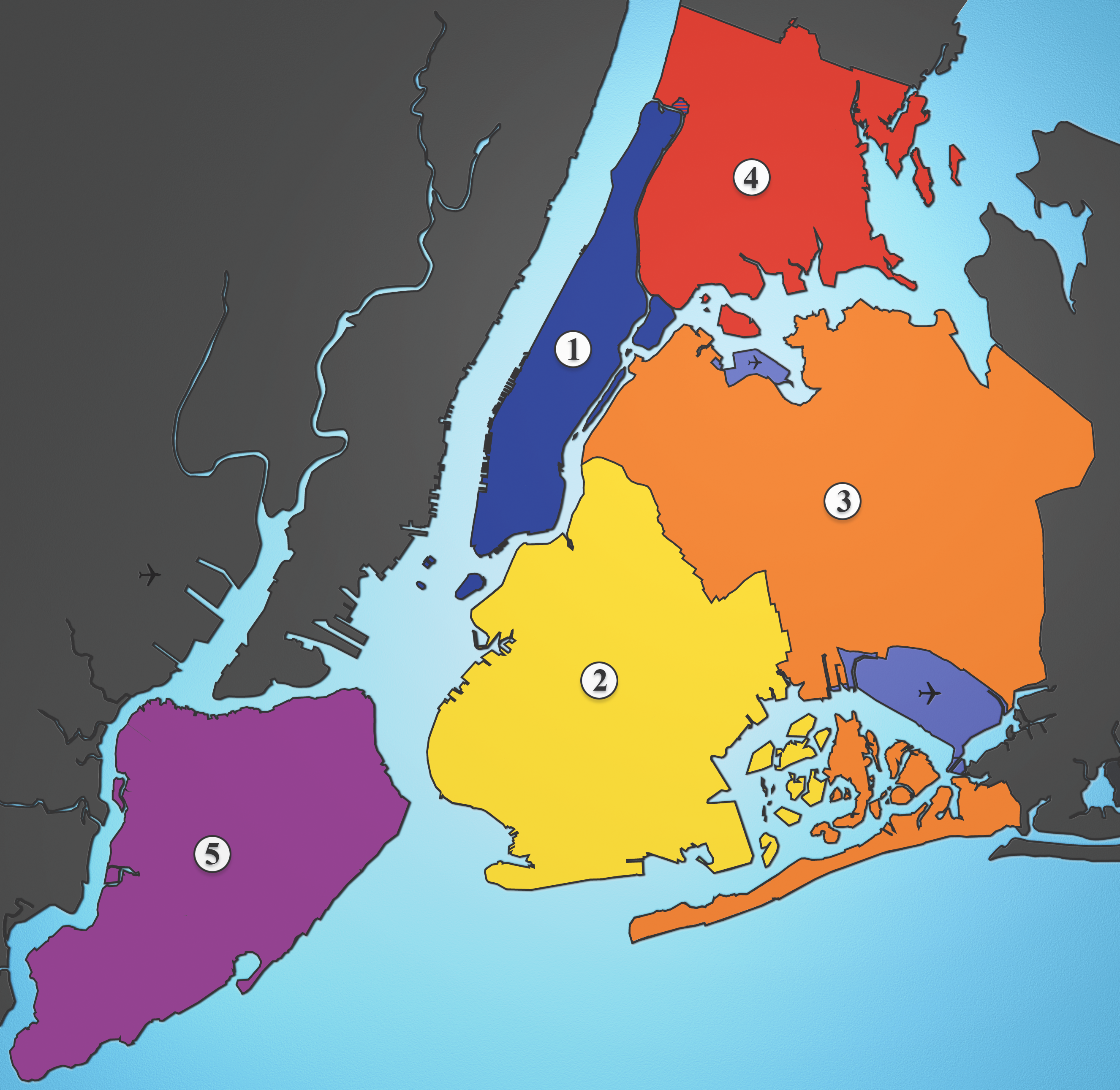
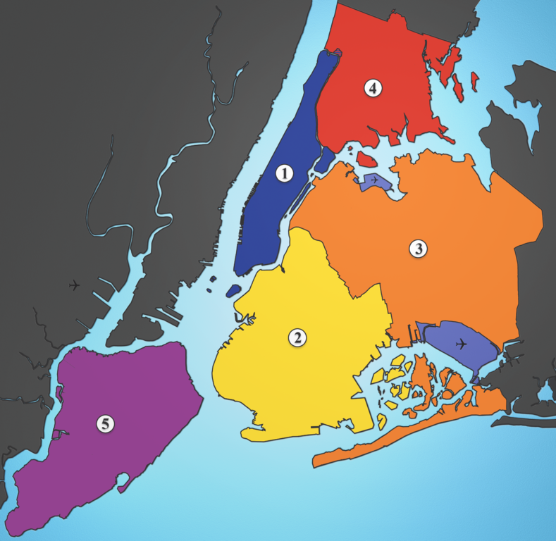
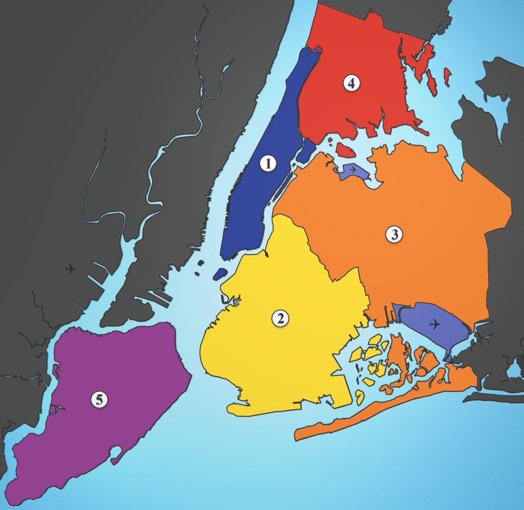
A map showing the five boroughs of New York City, as well as airports. Airports: North East: LGA; South East: JFK; West: EWR |
| Data | |
| Font | I created this image using various maps and images. |
| Autor | Julius Schorzman |
| Altres versions |
 |
Llicència
Aquest fitxer està publicat sota la llicència de Creative Commons Reconeixement i Compartir Igual 2.5 Genèrica.
- Sou lliure de:
- compartir – copiar, distribuir i comunicar públicament l'obra
- adaptar – fer-ne obres derivades
- Amb les condicions següents:
- reconeixement – Heu de donar la informació adequada sobre l'autor, proporcionar un enllaç a la llicència i indicar si s'han realitzat canvis. Podeu fer-ho amb qualsevol mitjà raonable, però de cap manera no suggereixi que l'autor us dóna suport o aprova l'ús que en feu.
- compartir igual – Si modifiqueu, transformeu, o generareu amb el material, haureu de distribuir les vostres contribucions sota una llicència similar o una de compatible com l'original
Historial del fitxer
Cliqueu una data/hora per veure el fitxer tal com era aleshores.
| Data/hora | Miniatura | Dimensions | Usuari/a | Comentari | |
|---|---|---|---|---|---|
| actual | 04:21, 19 ago 2005 | | 2.652 × 2.582 (6,5 Mo) | Quasipalm | A map showing the five boroughs of New York City, as well as airports. # Manhattan # Brooklyn # Queens # Bronx # Staten Island Airports: Nort East: LGA Sout East: JFK West: EWR Source: I created this image using various maps and images. {{cc-by-sa-2.5} |
Ús del fitxer
Les 2 pàgines següents utilitzen aquest fitxer:
Ús global del fitxer
Utilització d'aquest fitxer en altres wikis:
- Utilització a af.wikipedia.org
- Utilització a als.wikipedia.org
- Utilització a ar.wikipedia.org
- Utilització a ast.wikipedia.org
- Utilització a ay.wikipedia.org
- Utilització a be-tarask.wikipedia.org
- Utilització a be.wikipedia.org
- Utilització a bg.wikipedia.org
- Utilització a br.wikipedia.org
- Utilització a ca.wikipedia.org
- Utilització a da.wikipedia.org
- Utilització a de.wikipedia.org
- Utilització a de.wikivoyage.org
- Utilització a diq.wikipedia.org
- Utilització a el.wikipedia.org
- Utilització a en.wikipedia.org
- Utilització a en.wikiversity.org
- Utilització a eo.wikipedia.org
- Utilització a es.wikipedia.org
- Utilització a et.wikipedia.org
- Utilització a eu.wikipedia.org
- Utilització a ext.wikipedia.org
- Utilització a fa.wikipedia.org
- Utilització a fi.wikipedia.org
- Utilització a fo.wikipedia.org
- Utilització a frr.wikipedia.org
Vegeu més usos globals d'aquest fitxer.